 Go up
Go up


Editing the Map Legend
Posted on Nov 10, 2017 by Admin
Welcome to this week’s SimplyAnalytics blog post. Today we’re going to take a closer look at the options available to you when editing the map legend. Let’s get started!
First, to start editing your map legend click the Edit button located on the legend itself. Below we’ll discuss what each option does in more detail:
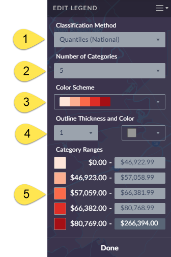
1) Classification Method - Determines the legend ranges for your map - you can choose between Quantiles (National), Quantiles (Local), Natural Breaks (Local), Natural Breaks (National), and Equal Intervals. TIP: By default maps are created using Quantiles National for any variable that you select - try switching to Quantiles Local to recalculate the legend ranges based on a sample of locations from the current map view. This can provide better local insight while also resulting in a more visually appealing map.
2.) Number of Categories - Determines how many legend ranges are available.
3.) Color Scheme - Choose from 9 color schemes to change the look of your map.
4.) Outline Thickness & Color - Allows you to change the outlines in your map - try changing the color and thickness to really alter the look and feel of your map.
5.) Category Ranges - You can select one of the available range boxes to enter your own value, and click on any of the associated colors to customize the color scheme!
Utilizing some of these color and boundary options available, you can create some unique and customized map designs that highlight key aspects of your research:
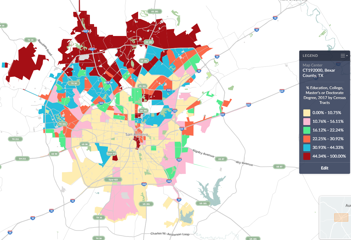
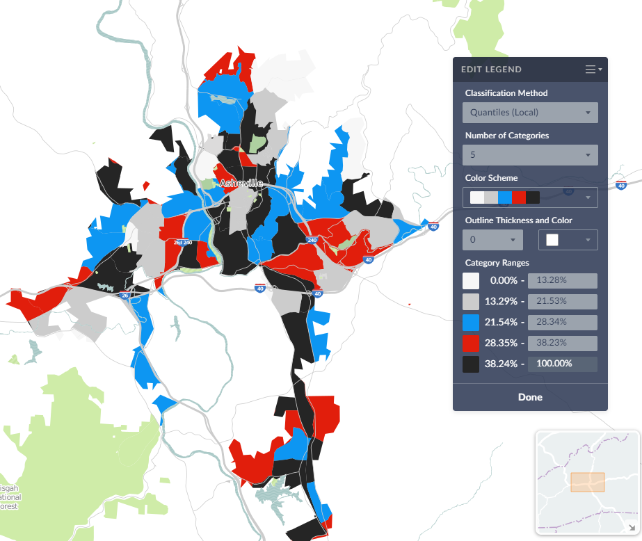
We hope this week’s entry has inspired you to explore the map legend a little more. Feel free to post a comment or tweet us your own unique map designs!
More from SimplyAnalytics


Posted on Mar 09, 2010 by Admin
The GRI team will be exhibiting at the 2010 Public Library Association conference later this month at the Oregon Convention Center in Portland, OR. The PLA National Conference is the prem...
Posted on Sep 05, 2019 by Admin
SimplyAnalytics will be exhibiting at the biennial North Carolina Library Association conference, to be held this year at the Winston-Salem Benton Convention Center. If you are attending,...
Posted on Nov 11, 2014 by Admin
With Veteran’s Day in the US this week, we thought it would be an ideal time to explore some of the variables in SimplyMap that pertain to veterans. Specifically, we wanted to know which ...
Posted on Nov 28, 2023 by Admin
Hello readers! We are happy to announce that SimplyAnalytics has successfully migrated to the Census 2020 boundaries on Sunday, November 19th. This blog will talk about what that is, what...
Posted on May 23, 2019 by Admin
Come visit the SimplyAnalytics team at the Special Library Association's Annual Conference in Cleveland. Special librarians and other information professionals come together at SLA’s annu...
Posted on Jun 25, 2015 by Admin
In this week’s SimplyMap report, we review the different options available when searching for a business. The easiest and fastest method of mapping businesses or creating a business repor...
Posted on Dec 08, 2010 by Admin
The GRI team will be attending the American Library Association Midwinter meeting this year at the San Diego Convention Center. Visit us in booth 1055 in the exhibit hall from January 7 -...
Posted on Feb 21, 2018 by Admin
We are looking forward to sharing SimplyAnalytics with the public library community at the upcoming PLA 2018 Conference in Philadelphia, PA. Our team will be exhibiting in Booth #855. Vis...
Posted on Feb 13, 2015 by Admin
In this week’s report exploring SimplyMap data, we want to find out where America’s remote workers reside. To find this, we can tap into the Census data in SimplyMap. The specific variabl...
Posted on Feb 24, 2019 by Admin
We will be exhibiting at SCELC* Vendor Day on March 14th. Visit us at table 510 and attend one of our two sessions demonstrating SimplyAnalytics. The presentations will highlight newly av...